Abandoned US 34 - Southeast Iowa
The original US 34 was paved in southeast Iowa between 1928 and 1930. Sometime in the late 1950's a new alignment of US 34 was built between Ottumwa and Chariton. Much of the abandoned sections are still around as County H35, winding thru Albia and over hills. A lot still has original pavement, and is maintained by Wapello and Monroe Counties
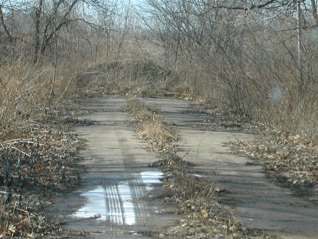
A few sections, though, were completely abandoned. These are in varying states of condition, but tells in its cracks the history of highways in Iowa.
All pictures taken 1/20/02.
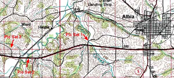
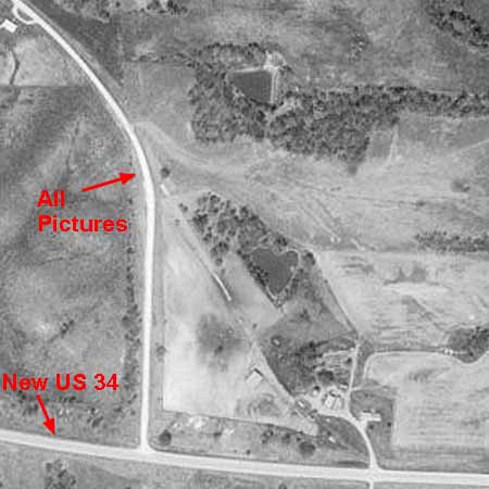
This map shows the location of the picture sets below.
Picture Set 1

Click on the picture for a zoom in:
|
Picture 1 (169 kb)
|
Picture 2 (165 kb)
|
 |
 |
|
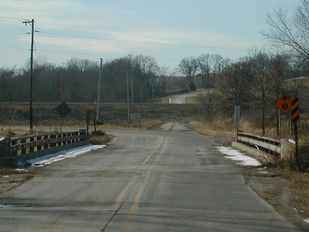
H35 curves left to intersect US 34, but the original
highway went straight. New 34 was built over the old road.
|
Old 34 ascends hill out of Coal Creek valley. Notice
the "curbs" on the road, even though we're miles out of the
city. Were these standard in the 1920s?
|
Picture Set 2
Click on the picture for a zoom in:
|
Picture 1 (173 kb)
|
Picture 2 (173 kb)
|
Picture 3 (178 kb)
|
 |
 |
 |
|
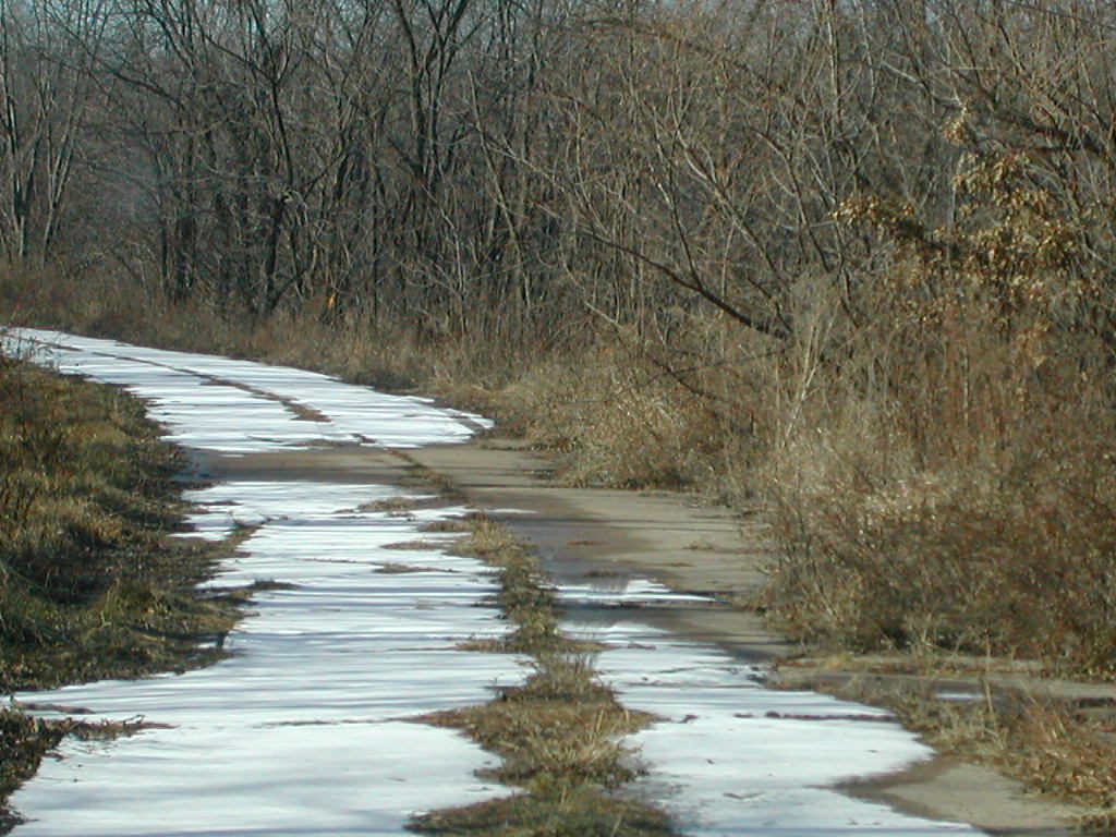
Grass and newfallen snow cover this abandoned section
of US 34.
|
Looking up abandoned US 34, you can see a semi-truck
rolling down the new highway.
|
Here's the end of this section of the abandoned highway,
approaching Cedar Creek.
|
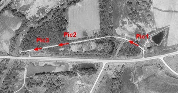
Picture Set 3
Click on the picture for a zoom in:
|
Picture 1 (179 kb)
|
Picture 2 (184 kb)
|
 |
 |
|
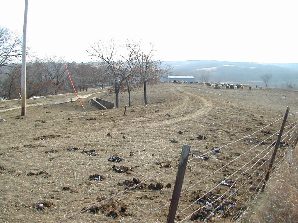
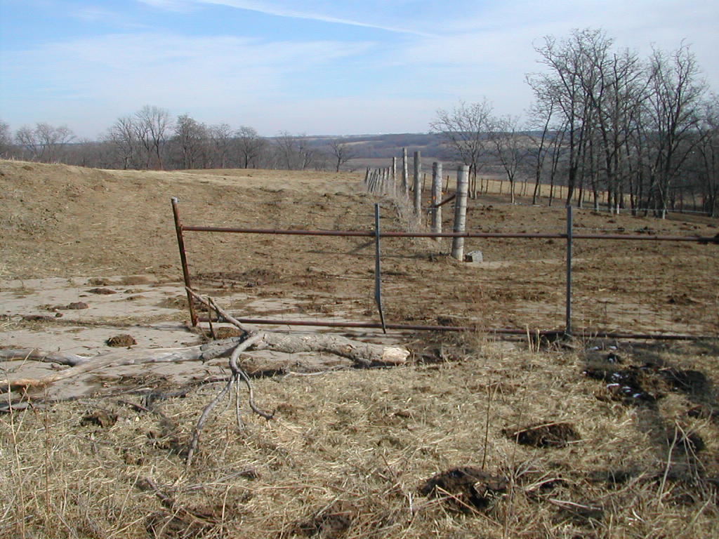
Here, old US 34 barely exists, as it's underneath
a cattle lot now.
|
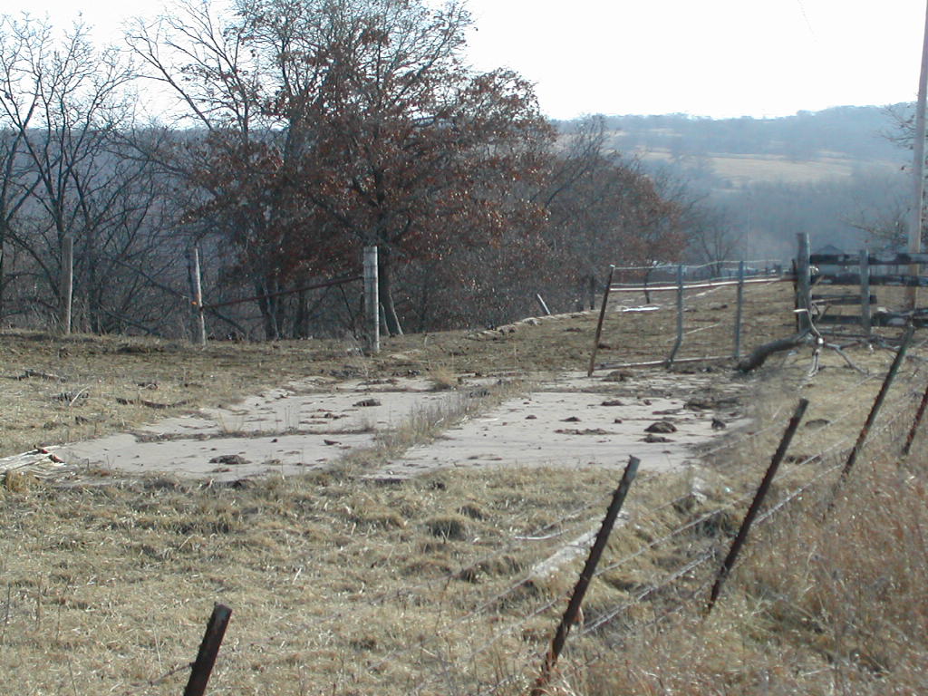
A zoom in on the old culvert. Again, you can see the
strange "curbs" on the sides of the old highway.
|
|
Picture 3 (180 kb)
|
Picture 4 (178 kb) |
 |
 |
|
Looking down old US 34 toward Cedar Creek.
|
Abandoned US 34 emerges thru the gate from the cattle
lot.
|
Other Pictures:
|
Picture 1 (164 kb)
|
Picture 2 (174 kb)
|
 |
 |
|
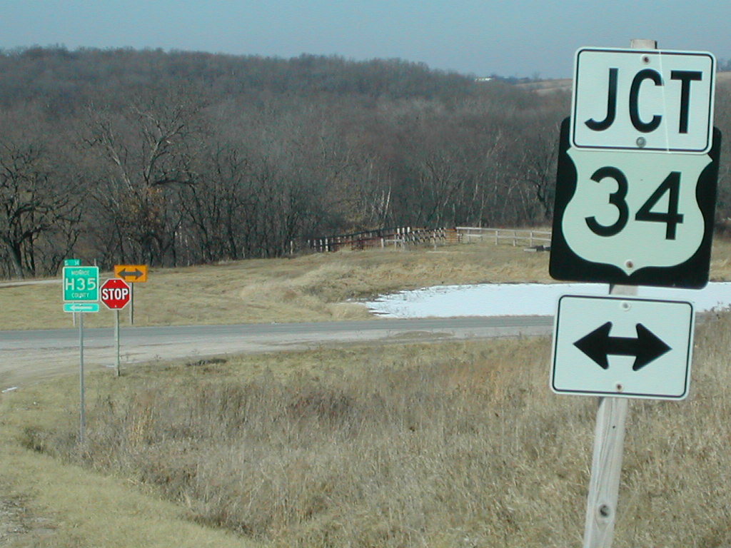
An older-style US 34 sign to go along with the old
highway. My guess is that it was posted in the late 1950s when they
built the new road.
|
There are even older-style county shields on H35.
|
Maps and aerial photos courtesy MSN's Terraserver.
Return to Neil Bratney's Homepage.
Page made 2/21/02 when I should have been studying.