Central Nebraska Roadtrip
April, 2002
Jeremy Lance came up from Kansas City for a weekend roadtrip with me through
Central Nebraska. In surfing the net, he had come across a page by the FHWA
about historic bridges in Nebraska, so we set out to survey several of these,
as well as introduce Mr. Lance to the beauty of the Nebraska Sandhills. Oh yeah,
we brought brownies, Cheetoes, Q-tips, and bait along with us this time. And
I learned how to use the parking brake.
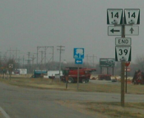
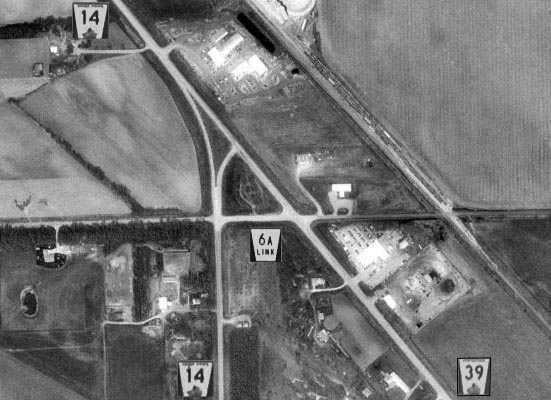
Of note, we discovered what may be the shortest signed highway in the
United States. More information below.
Click on the thumbnails to enlarge the picture.
Route: W Dodge Road and old Lincoln Highway west of Omaha; US 275 to Fremont,
US 30 to North Bend, various state and county hwys to Schuyler via Linwood,
and to the Columbus
Loup River Bridge on US 30 / 81.
|
|
|
|
|
|
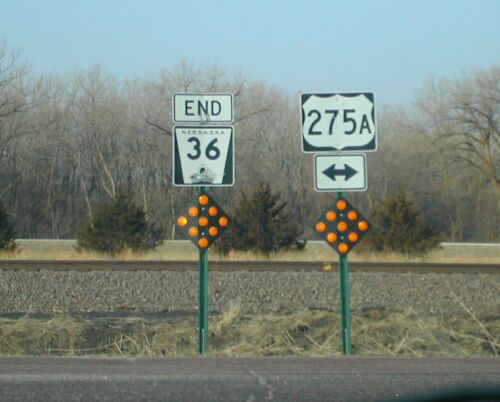
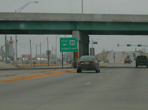
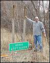
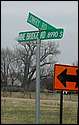
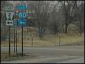
The western terminus of NE 36 is at US 275. However,
the new US 275 freeway had just been opened between Waterloo and Fremont.
The former roadway in Douglas County was signed for a short time as "US
275A" before it was converted to a county road.
|
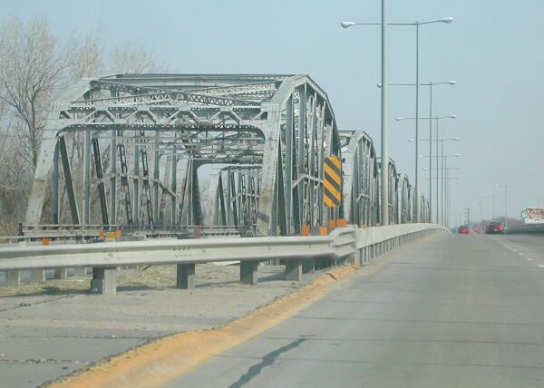
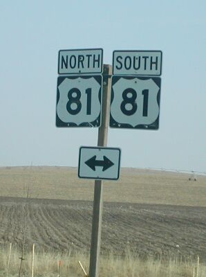
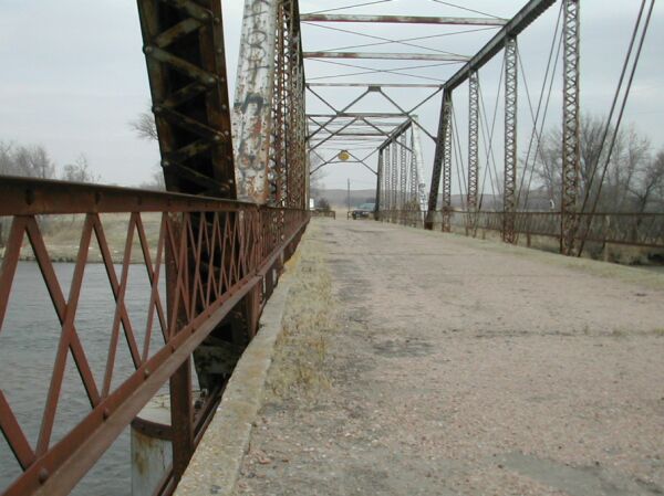
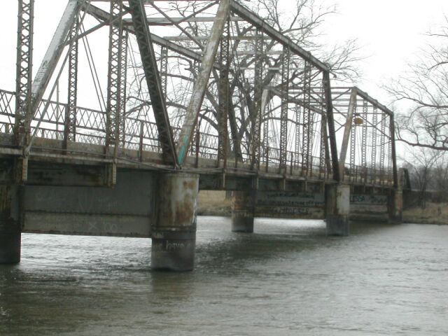
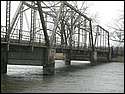
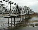
The first historic bridge we visited was the Loup
River Bridge for US 30 / 81 south of Columbus. The newer bridge carries
northbound traffic; the historic southbound bridge dates from 1930. Its
predecessor carried the Lincoln Highway here. |
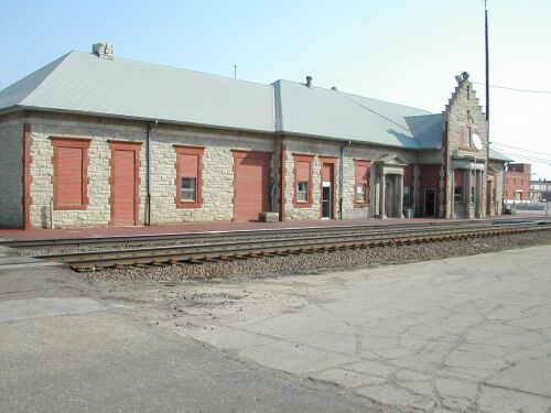
This cool stone railroad depot was in downtown Columbus.
|
Route: US 81 to NE 22 and NE 39 to Albion. NE 91 west to Spalding.
|
|
|
|
|
|
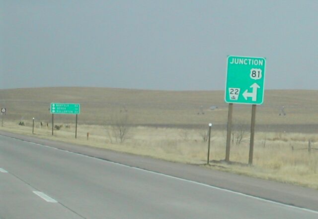
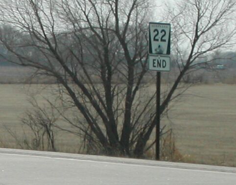
We passed the eastern terminus of NE 22 north of Columbus.
US 81 is a four lane expressway from Columbus 46 miles north to Norfolk.
Even so, I think two shields on the "double arrow" sign is excessive.
I love Nebraska's guide signs.
|
|
|
|
|
|
|
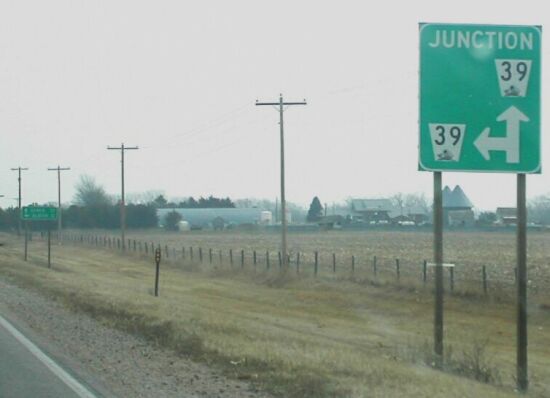
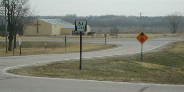
Here's the end of Link 12A, a shortcut between NE 22
and NE 39 near Genoa. Nebraska has many of these Link and Spur routes.
The number (12) indicates the county (Butler); routes in the county are
lettered sequentially.
|
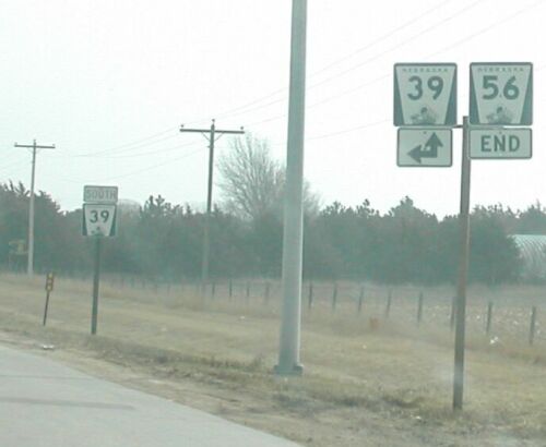
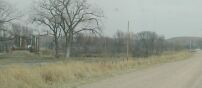
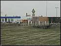
We also visited the eastern terminus of NE 56 near St.
Edward.
|
What a suprise! Our favorite character from #roadgeek
is full of shit again!
|
Route: (Very) old US 281 over crooked gravel roads to Bartlett. NE 91 to
Burwell, and around Calamus Reservoir. US 183 to Taylor and NE 91 back to Taylor.
 |
 |
 |
 |
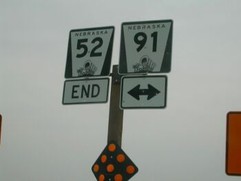
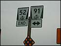
| Another terminus: NE 52 near Primrose |
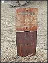
We took an old, old route of US 281 indicated on a 1935 Nebraska map.
Unfortunately just a gravel road today. We found this faded sign, but couldn't
interpret it. |
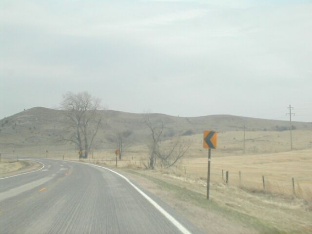
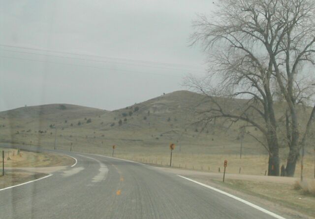
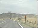
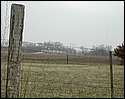
Scenery on NE 91 west of Taylor. The
fringe of Nebraska's sand hills. |
Route: NE 11 though Ord, and visiting historic North
Loup Bridge near North Loup.
 |
 |
 |
 |
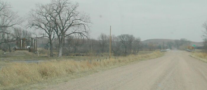
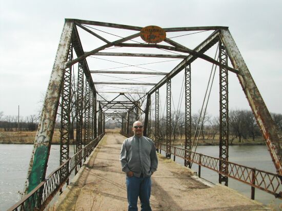
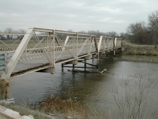
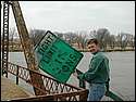
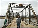
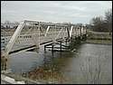
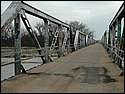
| We visited the North
Loup Bridge in Valley County, Nebraska, about 3 miles northwest of the
town of North Loup. It was built in 1912 and was the first rural bridge
built over the river in the area. The leftmost picture shows where this
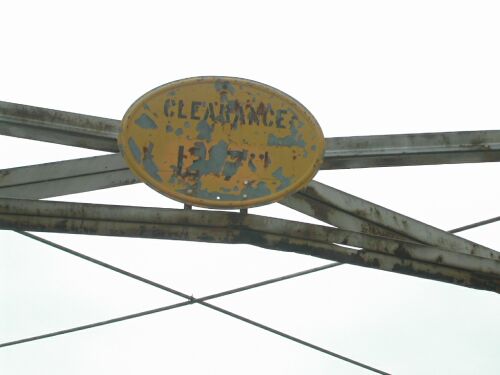
bridge lies in comparison to the current bridge. Signs were left over at
the east side of the bridge. The sign overhanging the bridge says "Clearance
13' 7"," but was painted over "Welcome to Valley County" |
 |
 |
 |
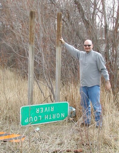
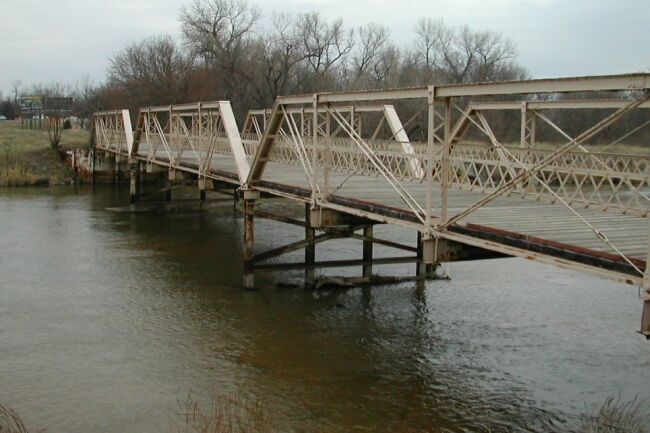
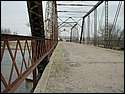
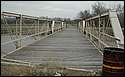
| Jeremy's standing at the bridge's east flank. You can tell this bridge
is quite narrow, 14'8" to be exact. Jeremy's pretty skinny, too. |
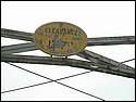
On the bridge, you can see the wear of the surface., and the state of
the iron. |
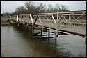
Looking at the bridge from the eastern bank of the river. On the far end
is one "pony truss" element (see below). |
Route: Southeast to US 281, and around Grand Island. Visited various historic
bridges of Hall County, south of Grand Island.
 |
 |
 |
 |
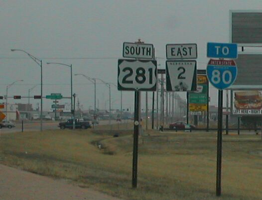
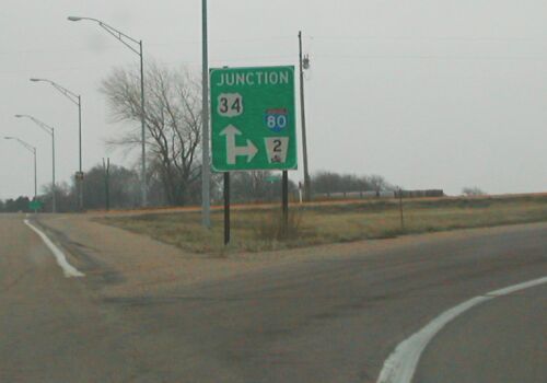
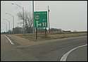
| Entering Grand Island on the US 281 / NE 2 multiplex. NE 2 won't be alone
between here and Lincoln. |
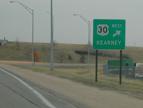
Signage around the US 30 intersection on US 281. |
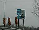
NE 2 goes east a bit with US 34 before it dissolves into I-80 for 90 miles.
US 34 goes south with US 281 from Grand Island to Hastings. |
 |
 |
 |
 |
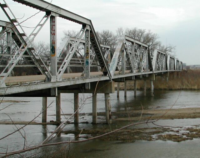
| The first bridge
we visited in Hall County was near US 281/US 34, about a mile north
of I-80. The left most picture is taken from 281/34, looking west. It is
a "pony truss" bridge, which means that it is constructed with
several spans not tall enough to require overhead lateral support. Compare
it with the usual truss design, seen above at the North Loup bridge. Pony
trusses were inexpensive and ideal for Nebraska's wide, shallow rivers.
This bridge originally was located at another crossing, and consisted of
ten such pony trusses, making it the longest bridge constructed in this
manner. |
 |
 |
 |
 |
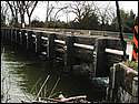
| The next bridge we visited was southwest of Grand Island.
The "Nine
Bridges Bridge" carried the original highway south of Grand Island
to Hastings, 3/4 mile east of current US 281/34. (The road today is named
Nine Bridge Rd.) This bridge was a subtype of the "pony truss"
which required shorter spans, thus it was named "nine bridges."
It was built in 1913, and is one of very few remaining today. |
 |
 |
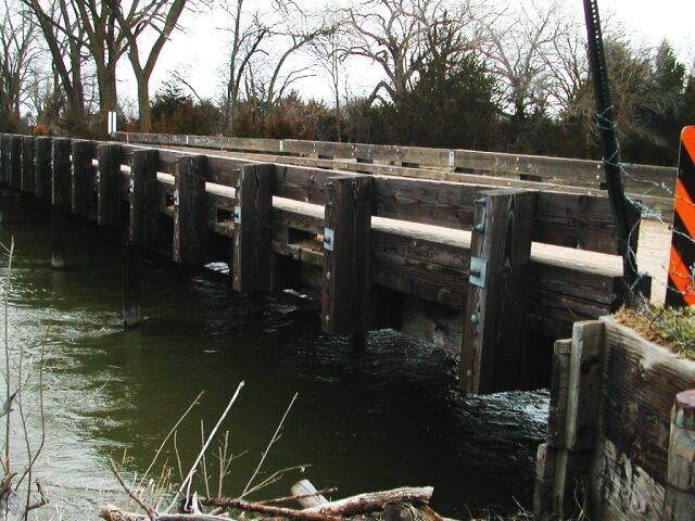
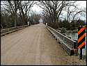
| Finally, we found a wooden bridge along this same thoroughfare
between Grand Island and Hastings. It is about 1.5 miles north of the Nine
Bridges Bridge also on Nine Bridge Rd. It is not mentioned on the FHWA site,
so I don't have info about age, etc. |
Route: East on I-80 to Omaha.
 |
 |
 |
 |
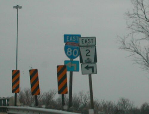
| NE 2 stretches all the way east to west across the state.
Between Grand Island and Lincoln, it used to be multiplexed first with US
34 and later with I-80. Here, east of Grand Island, NE 2 leaves US 34 and
heads south to I-80. |
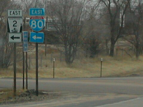
Today, there is officially a gap in NE 2 between this interchange,
number 318, east of Grand Island to the US 77 SPUI interchange on the southside
of Lincoln. However, signs at this intersection still direct eastbound NE
2 traffic onto east I-80. |
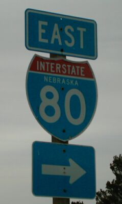
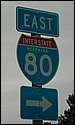
This is one of few I-80 shields in Nebraska still with the state name. |
Written by Neil Alexander Bratney
Questions? Comments? Like to use a file? Please
e-mail me.
Go to Neil Bratney's Homepage.
Page Created September 25, 2002.