Route: I-90 to MN / IA 60 to IA 9
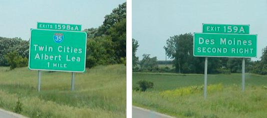 |
Des Moines seems to get second billing to Albert Lea on I-90 signs aproaching the I-35 junction. |
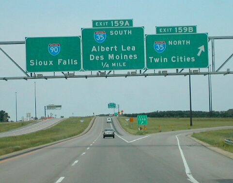 |
At the interchange, both cities are on the bubble-copy style sign. |
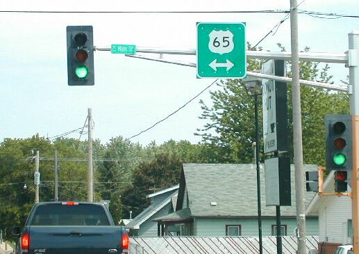 |
US highways are well marked on the city streets of Albert Lea. |
 |
North out of Albert Lea, smaller control cities of Blue Earth and Ausin are indicated on the I-90 guide signs. |
 |
US 71 crosses the West Fork Des Moines River in Jackson, MN. |
| Here's the exit signs for MN 60 from I-90. Signage for Sioux City only. IA and MN 60 make up a straight shot from Sioux City to the Twin Cities. | |
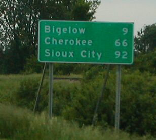 |
Distance signs on IA 60 point to LeMars at the farthest, but Minnesota keeps its eyes on the prize and tells travellers the distance to Sioux City. |
 |
Nice guide signs at the split of US 59 and MN 60. US 59 goes to Cherokee, IA, and MN / IA 60 goes to Sioux City. |
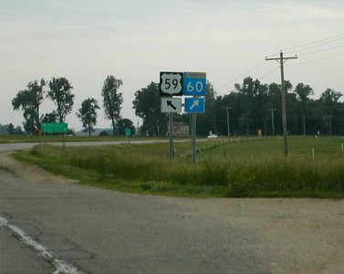 |
Route shields indicate the split of US 59 and MN 60. |
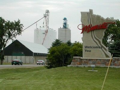 |
A Type III "Welcome to Minnesota on MN 60. I think the big sign is indicitive of both the traffic counts on this diagonal highway, as well as being consious of plans to upgrade to expressway. More pictures from this border crossing. |
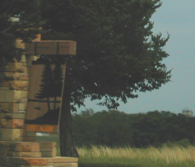 |
US 75 traces the Minnesota - Iowa border for about 1/2 mile. A Type II "Welcome to Minnesota" is along this E-W state line section of US 75. The back side says, "Visit Again." |
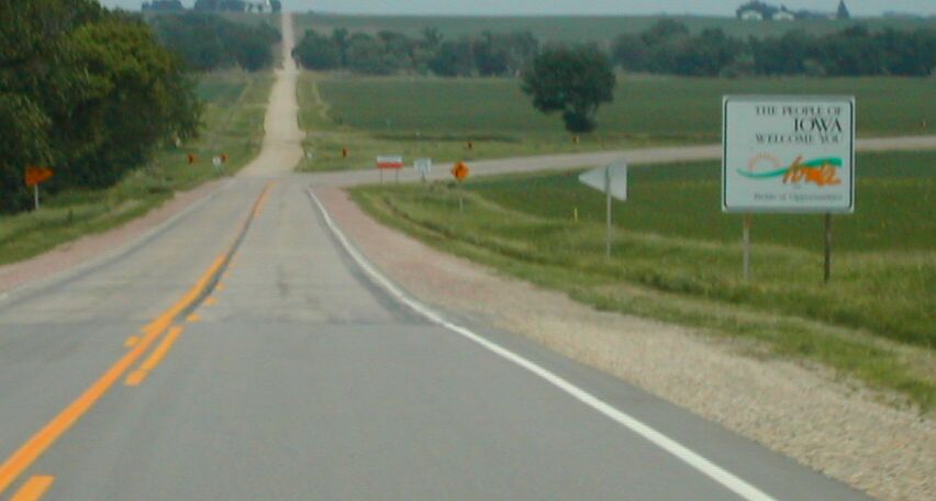 |
Since this section of highway is in both states, Minnesota maintains the western portion, and Iowa the eastern. Each section is connected to the remainder of highway in the respective states. In this picture, you can see the pavement change, as well as the "Welcome to Iowa" sign right at the half way point. |
 |
A Rock County, MN, road continues east from this E-W portion of US 75. |
 |
Here is the front of the Type II "Welcome to Minnesota" sign, again at the halfway point of the E-W section. |
| On US 75, just turned north into Minnesota. Here is the Rock County sign. | |
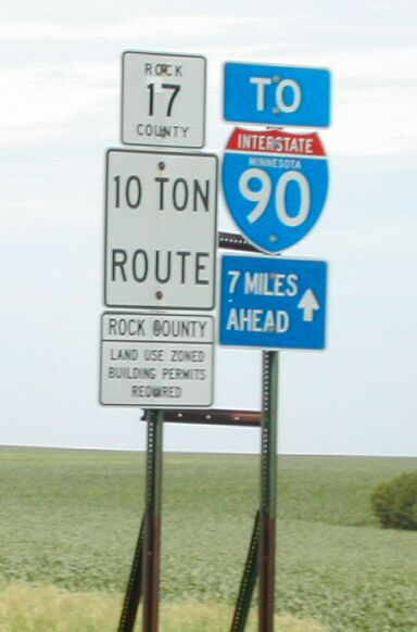 |
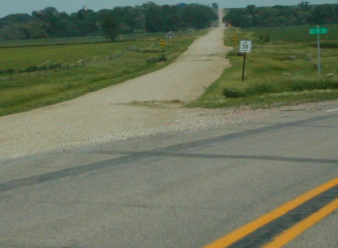
At the Iowa / Minnesota state line, one mile east from South Dakota. This sign indicates exactly how far it is to I-90 along Rock Co 17. (of course, who knows how many people are driving along K16 here, wondering the distance to I-90?) |
 |
Lyon Co K16 goes east and west along the border, and here turns south toward Larchwood. |
| I stopped at the Tri-state Marker between Minnesota, Iowa and South Dakota. | |
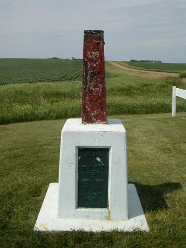 |
Looking at the marker from the Iowa side. On the east and west sides, 43° 30' is written on the marker |
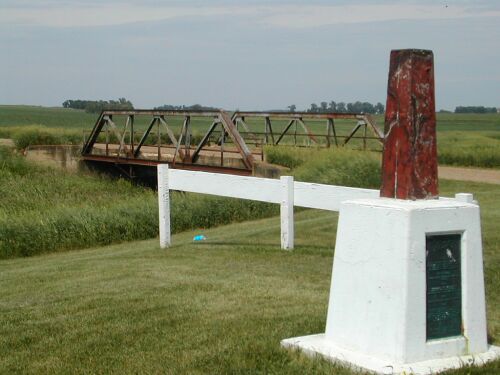 |
A cool old truss bridge is north of the marker on this N-S highway just inside Minnesota |
 |
The text on the side of the marker details the history of the Tri-state marker. |
| Also see terminus pictures for IA 15, IA 4, IA 60, IA 91, IA 9. | |
Route: IA 182 to US 18 to Iowa and South Dakota Co Hwys to
SD 46
to IA 10 to IA 12 to I-29
 |
An unusual 4 digit county road sign in Iowa. This road goes from near US 18's curve west of Rock Valley, then northwest toward Canton, SD. |
 |
Southbound on IA 12, you encounter this very odd sign. Not only is it an old-style South Dakota state highway sign with faces of Mt. Rushmore, but it also reveals the old SD 38 number under the current SD 48. |
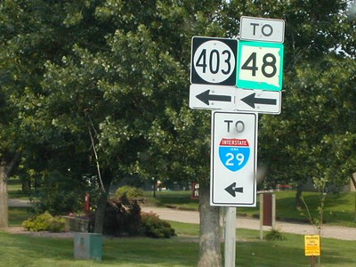 |
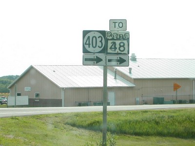
Facing north, you see a modern South Dakota state highway shield as well as an Iowa-style "To" interstate sign. (it even has "Iowa" written on the interstate shield, even though the intesection with I-29 is in SD.) More pictures of IA 403's termini. |
| See also termini pictures of IA 182, IA 10, IA 12, IA 3. | |
 |
IA 12 intesects with IA 3 just south of the IA 403 intesection. Instead of continuing west from Akron into South Dakota, IA 3 mulitplexes with IA 12 for a few miles farther south, and turns into SD 50, an important highway to Yankton and Vermillion, SD. |
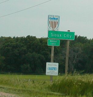 |
IA 12 crosses the Sioux City limits. |
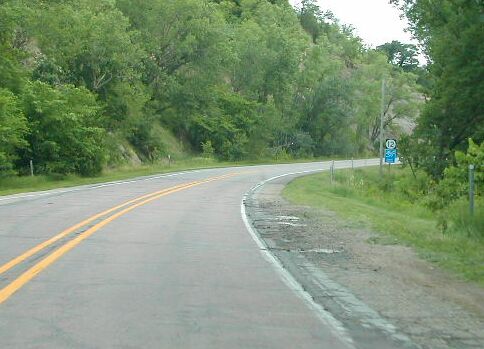 |
Sioux City is near the northern edge of the Loess Hills, and IA 12 winds through the Big Sioux valley. |
 |
IA 12 approaches I-29. At the west edge of Sioux City. This is currently the southern terminus of IA 12, although the signs indicate differently. Signs direct IA 12 traffic along its former route, onto South I-29. |
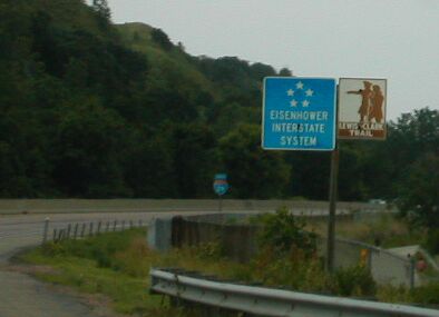 |
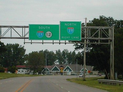
The section of I-29 through Sioux City is part of the Lewis and Clark Trail. |
 |
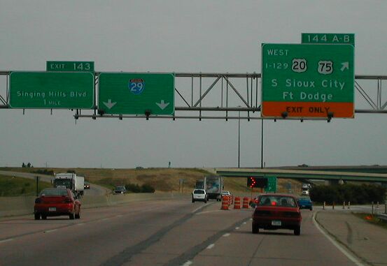
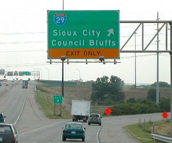
Approaching what has been called "Iowa's Stuipidest Intersection," the volleyball interchange at the northern terminus of US 77. |
 |
Same interchange. Traffic on I-29 goes unimpeded on the bottom, and traffic on US 77 goes unimpeded on the top. Four stoplights at corners of a square regulate all turning traffic. |
 |
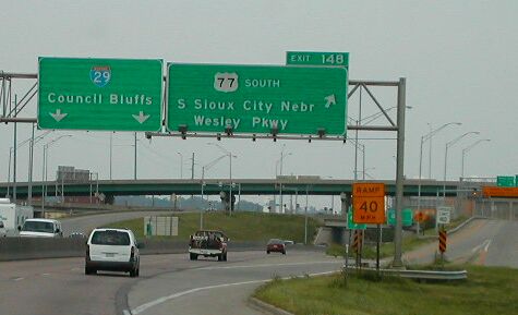
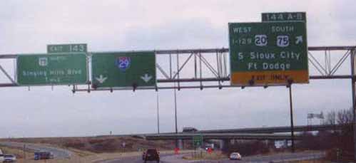
A bypass for US 75 (northeast toward IA 60) was built east of Sioux City, and opened last year. New signs have been posted on I-29 indicating US 75's new route. Also notice the I-129 in text! |
 |
Signage at the exit ramp for I-129 / US 20/75. Compare it with the next picture below. A US 75 shield has been removed from the farthest left sign, and the "SOUTH" has been removed above the 75 shield on the right. |
 |
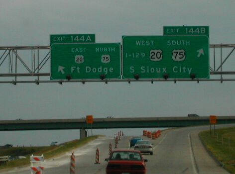
Compare the previous picture with this one taken by me 11/01, after the 75 bypass was complete, but before signs were changed. |
 |
Signs on the distributor from I-29. Looks like mini-shields on the left sign. |
 |
Exiting to I-29 from US 20 west / US 75 south. Note that a US 75 has also been removed from this shield. |
 |
On the distributor from US 20/75... you can see a shadow from where the 75 shield used to be on the left BGS. |
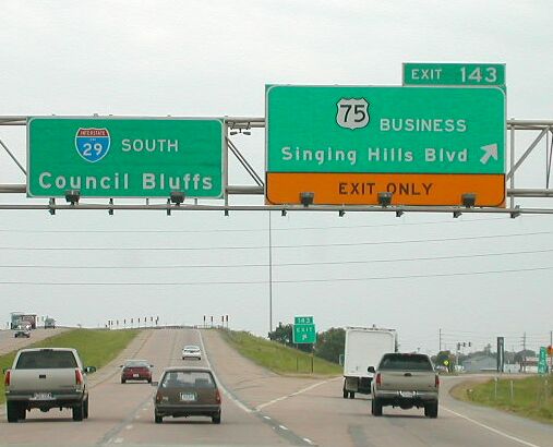 |
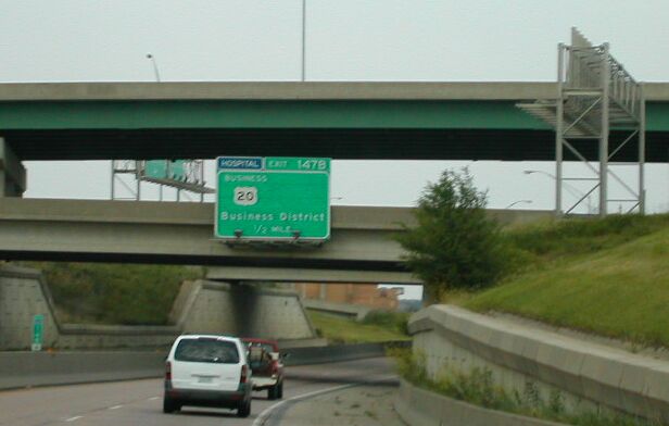
This road formerly was US 75 through mid-town Sioux City, but now it is only Bus 75. |
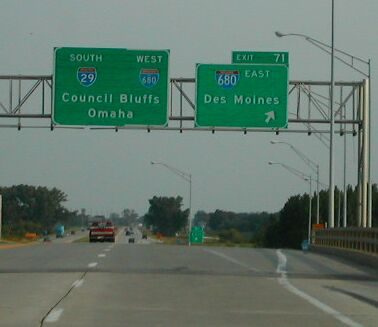 |
I-680 meets I-29 here about 20 miles north of Omaha. 680 serves as a cut-off for people coming from Des Moines, heading for Sioux City, or due east to Fremont, NE, for example. |
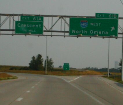 |
I-680 leaves its multiplex with I-29, heading to North Omaha. The opposite side of this cloverleaf heads to Crescent, IA, and is marked as IA 988 from eastbound I-680 and northbound I-29. |
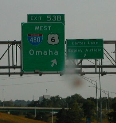 |
Finally home! Notice that a.) there's no exit for East US 6, and b.) Carter Lake, IA, and the airport are on a separate sign. Please ignore the bug on my windshield. |
Go to Page 1: Iowa, Missouri, Illinois,
Indiana, Michigan
Go to Page 2: Michigan and Ontario
Go to Page 3: Michigan, Indiana, Illinois, Wisconsin
and Minnesota
Go to Roadtrip '02 Index